

More than Surveying
At Survey City, we capture spaces in ways that are accurate, useful and engaging - combining professional surveying with the latest 3D scanning, reality capture, 360° and drone technology.
With over 14 years of surveying experience, we bring technical accuracy together with modern capture technology to document buildings, land and spaces of virtually every kind.
Our services include 3D laser scanning, interactive 360° virtual tours, measured building surveys, topographical surveys, drone surveys and inspections, 3D point clouds, floor plans, elevations and 3D modelling.
From homes, commercial properties and development sites to stadiums, churches, heritage buildings, restaurants, hotels, showrooms, industrial facilities and entertainment venues, we tailor our approach to the space and what you want to achieve.
Whether you need accurate measurements for design and development, a detailed digital record of an existing building, or an immersive 360° experience that people can explore from anywhere, we can provide the right solution.
Based in Hull, East Yorkshire, we work with clients across the UK and internationally.
Survey • Scan • Capture • Explore • Model • Deliver

What we Deliver
Accurate survey data, immersive digital experiences and detailed deliverables tailored to your space and requirements.
Interactive 360° Virtual Tours • Registered 3D Point Clouds • 3D Models • 2D CAD Drawings • Measured Floor Plans • Elevations & Sections • Topographical Drawings • Drone Imagery & Mapping
From Reality to Digital
See how we capture real world spaces and transform them into accurate survey information and detailed deliverables.
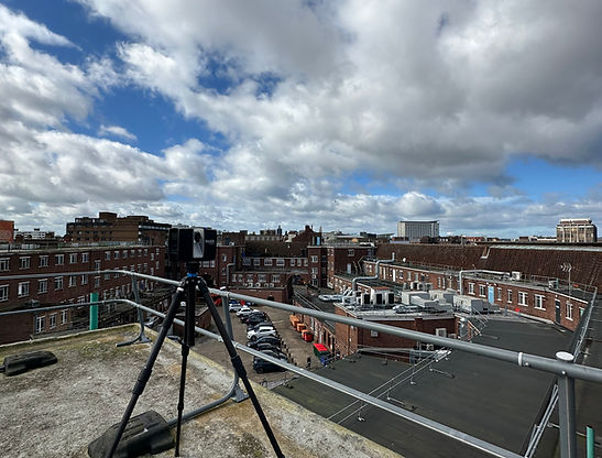


3D LASER SCANNING
Capturing real-world spaces accurately using professional 3D laser scanning technology.
3D POINT CLOUD
Creating a detailed digital representation containing millions of measured points.
MEASURED DRAWING
Transforming captured survey data into accurate drawings ready for design and development.
Our Services
Surveying, Reality Capture & Digital Experiences
3D Laser Scanning
Accurate 3D Reality Capture
Our 3D laser scanning service captures highly accurate, detailed digital information from buildings, structures and spaces of virtually any size or complexity.
Using professional laser scanning technology, we capture millions of measurement points to create an accurate 3D representation of the existing environment - from homes and heritage buildings to stadiums, commercial properties and complex industrial facilities.
The captured data can be used to produce registered point clouds, measured floor plans, elevations, sections and detailed 3D models, or supplied directly for use within CAD, Revit and other design software.
Ideal for design, refurbishment, redevelopment, documentation and digital record purposes, 3D laser scanning provides a fast and reliable way to capture the real world in exceptional detail.
Interactive 360° Virtual Tours
Immersive Digital Experiences
Utilizing advanced 3D point cloud laser scanning technology, we create detailed digital 3D point cloud models of structures and terrains. This service is invaluable for applications such as building information modelling (BIM), heritage preservation, and infrastructure planning.
Our interactive 360° virtual tours transform physical spaces into immersive digital experiences that can be explored from virtually anywhere in the world.
Using high-resolution 360° panoramic imagery, we create intuitive virtual environments that allow people to move naturally through a space and explore it from their phone, computer or compatible VR device.
Tours can include interactive information points containing text, photography, video and links, creating engaging experiences for stadiums, churches, heritage sites, museums, restaurants, hotels, showrooms, entertainment venues, commercial properties and many other spaces.
Whether used for marketing, visitor engagement, remote access, documentation or simply to showcase a space, the completed tour can be embedded directly into a website and shared online with customers, visitors, fans or stakeholders.
Measured Building Surveys
Detailed Existing Building Surveys
Our measured building surveys provide accurate and detailed information on the existing layout, dimensions and features of a building or structure.
Using 3D laser scanning technology, we digitally capture buildings internally and externally, allowing large amounts of accurate measurement data to be collected while creating a comprehensive digital record of the property at the time of survey.
Depending on your requirements, deliverables can include measured floor plans, external and internal elevations, sections, roof plans, registered point clouds and detailed 3D models.
Suitable for residential, commercial, heritage and industrial properties, measured building surveys can support refurbishment, renovation, extension, redevelopment, design and documentation projects.
Topographical Surveys
Land, Levels & Site Features
Our topographical surveys provide an accurate representation of existing site features, levels and layout, providing reliable information for planning, design and development.
Surveys can include ground levels, buildings, boundaries, walls, fences, roads, kerbs, paths, drainage features, utilities, vegetation and other visible site features depending on the requirements of the project.
Using modern surveying technology including GNSS and 3D laser scanning where appropriate, we efficiently capture both site levels and detailed surrounding features.
Completed surveys can be supplied as detailed 2D CAD drawings suitable for architects, engineers, designers, developers and other project professionals.
Drone Surveys & Inspections
Aerial Surveying & Inspection
Our drone services provide high-resolution aerial imagery and data, offering a different perspective for surveying, inspection, mapping and visual documentation.
Drone capture can be used for roof and façade inspections, site surveys, aerial mapping, construction progress monitoring, land and property documentation and general condition assessments.
It is particularly useful for areas that may be difficult, time-consuming or unsafe to access using traditional methods.
Depending on the project, deliverables can include high-resolution aerial photography, video footage, inspection imagery, site overviews and detailed aerial mapping.
Spaces We Capture
Residential • Commercial • Stadiums & Sports Venues • Churches & Heritage • Industrial & Manufacturing • Hotels & Hospitality • Restaurants & Bars • Automotive & Showrooms • Museums & Visitor Attractions • Retail • Entertainment Venues • Construction & Development
★★★★★
Ash was brilliant. Survey conducted really quickly and to an outstanding standard. - Kris K.
★★★★★
Ashley came and did a great 360 survey of the interior of St John's. We're really pleased with the virtual tour that we can now make available to visitors on our website. We are hopeful that the drone survey of the roof will also be of great help to us and our architect in some future maintenance work. - Hannah M.
★★★★★
Excellent service from Ashley very professional from start to finish
Very happy with the data he provided for my shop.
Thankyou so much. - Kerry L.
Reviews
Our Case Studies
Explore three standout projects from Survey City, including Hull Minster, the Future Shmuseum and a major city-centre survey project. From heritage buildings to large-scale commercial spaces, these case studies show how we use 3D laser scanning, measured building surveys and reality capture to deliver accurate, high-quality information.
Explore Our Work
